Three cyclones in three weeks: why the Bay of Bengal is so stormy this year, explained
Arnab, Murasu and Akvan hit India's east coast within about three weeks. IMD's chief links their unusual track to a strong El Niño. Here is what is happening and what comes next.
Key points
- Three named cyclones, Arnab, Murasu and Akvan, formed in the Bay of Bengal in about three weeks
- Arnab made landfall on 28 October, Murasu hit Andhra Pradesh on 2 November and Akvan crossed near Gopalpur on 20 November
- October and November are the most active months, with about three systems forming in a typical year, IMD says
- IMD chief Mrutyunjay Mohapatra links the cyclones' track towards Andhra Pradesh to El Niño
- US scientists expect a strong El Niño to last until early 2027
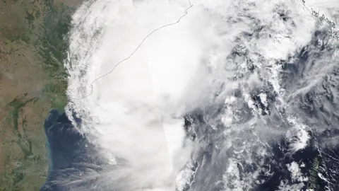
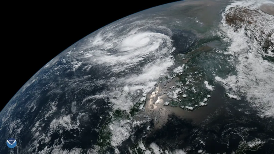
India's east coast has been hit by three cyclones in about three weeks. Arnab, Murasu and Akvan all formed in the Bay of Bengal between late October and late November 2026, flooding parts of Odisha and Andhra Pradesh and forcing hundreds of thousands of people from their homes.
Is this normal? Partly. But the India Meteorological Department (IMD) says one thing about this season is unusual, and it points to El Niño.
The three cyclones
- Arnab: made landfall in Andhra Pradesh on 28 October and caused severe floods in southern Odisha. At least 11 people were killed and six were missing in cyclone-linked incidents, officials said, according to PTI.
- Murasu: hit the Andhra Pradesh coast on 2 November, bringing heavy rain.
- Akvan: crossed the coast near Gopalpur in Odisha on 20 November. Nearly 300,000 people were moved to relief camps before it arrived.

Why so many cyclones?
October and November are the busiest months for cyclones in the Bay of Bengal. About three cyclonic systems form in this period in a typical year, IMD Director General Mrutyunjay Mohapatra said, according to ETV Bharat. So three in a season is not, by itself, a record.
What he called unusual is that the storms kept heading for the same stretch of coast. "During El Niño years, it has been observed that most cyclones develop at lower latitudes and move towards Andhra Pradesh and Tamil Nadu," Mohapatra said.
What is El Niño, and how strong is it?
El Niño is a warming of the Pacific Ocean that changes weather patterns around the world. The US weather agency NOAA reported in mid-November that the key Pacific temperature measure was about 2.5°C above normal, and that a strong to very strong El Niño is likely to last until early 2027, ETV Bharat reported.
Scientists caution that El Niño alone does not decide where a cyclone forms or goes. Warm sea water, which acts as fuel for storms, and large weather systems such as the Madden-Julian Oscillation also play a role. IMD's advisory noted very high heat energy in the ocean near Akvan as it formed.
📄 Official forecasts and alerts
Who names cyclones?
Cyclones in the North Indian Ocean get their names from a list prepared by 13 countries of the WMO/ESCAP Panel on Tropical Cyclones, including India, Bangladesh and Iran. Names are used in order, and a name is never reused.
What comes next
- The cyclone season usually eases in December, but late-season storms are possible.
- With a strong El Niño, scientists will watch whether India's winter and next year's monsoon are affected.
- Coastal residents should follow IMD bulletins and local district alerts during any warning.